Showing posts with label under $5. Show all posts

Wednesday, November 25, 2015

Hidden Outdoor Treasure in Mississippi


Nestled between Natchez and Brookhaven, MS is Homochitto National Forest.  This outdoor haven is perfect for Frugal Family Travelers who enjoy camping, hiking and mountain biking!  Did you know that Homochitto National Forest is one of 6 National Forests in the state of Mississippi and provides over 1.2 million acres of exploration?  With that being said, our day of exploration was spent in the heart of Homochitto at the Clear Springs Recreational Area.  Clear Springs is situated around a spring fed lake, which was constructed by the Civilian Conservation Corp. (CCC) in the 1930's.  Adjacent to the lake is a small campground (with water and electricity), pavillion, restrooms, and playground.  In this area you will find several beautiful trails for both the hiking and mountain biking enthusiast.  The map below outlines the trails to be explored with the pictures featuring the 1 mile loop trail directly around the lake area.  Whether, camping, hiking or biking, your Frugal Family Travelers are sure to enjoy this little slice of heaven in Mississippi.  It's a little bit like being in the mountains without the extensive drive to get there! 


Fees/Directions: 

Clear Springs Recrearional Area has an honor box and offers no reservations. Those wanting to park an RV or pop a tent should be aware that the system operates with an honor box and in a first come first serve basis.  Also, there are several bathrooms, near the campground, with showers. 

$20 for developed sites with water and electricity 
$7 for primitive camping
$5 for day use area 

Take caution when using GPS.  It may lead you to the national forest itself but not directly to the Clear Springs area.  Remember, the forest is huge so it is advised to route the GPS to Meadville, MS and then the follow the directions on the picture below.   These will get you there safe and sound!  


Disclaimer:
All content provided on Frugal Family Travelers blog is for informational purposes only. The owners of this blog make no representations as to the accuracy or completeness of any information on this site or found by following any link on this site.  The owners of Frugal Family Travelers blog do not share personal information with third-parties and are not responsible for the republishing of the content found on this blog on other Web sites or media without permission.  As with all travel, operating days, times, costs, etc., should be verified prior to departure.

View FrugalFamilyTraveler's photos on Trover

Monday, July 13, 2015

A Great Place for Summer Fun on the Northshore!


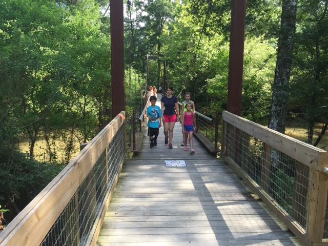
Tickfaw State Park is located right outside Hammond, LA in Springfield.  Wooded and lush, it is the perfect place to spend a day hiking, canoeing or cooling off at the splash pad. For those looking for a vacation or weekend getaway, the cabins and camping sites will provide the atmosphere for which you are looking.   For those who enjoy hiking, the river trail is beautiful, as it actually parallels the river for the greater part of the hike, which provides an opportunity to observe all sorts of wildlife. There is also an amazing bridge at the end of the trail which joins the boardwalk trail, creating a loop back to the parking area.   "Loop" simply means that the trail will take the hiker back to the original departure point. Those traveling with kids will appreciate loop trails because they take the guesswork out of the hike and eliminate backtracking.  If you enjoy fishing, take a break at the bridge, and cast your fishing line to get your "catch of the day".   However, make sure to purchase a fishing licence from the Department of Wildlife and Fisheries  before casting that line into the water as a licence is required to do so.     Note: Access to the river trail is gained from the parking area down the road from the day use area which contains the splash pad.  Enjoy and picnic at the Bottomland/Hardwood Pavillion after your hike or at any of the designated picnic areas in the park.  See the map below for the locations of all of the offernings in the park!   Place a call to the park office before you depart if you plan to canoe.  In times when water levels are too high or low canoeing is not allowed.

If you are a frequent follower of our blog you know how Frugal Family Travelers feel about the State Park System and capitalizing on an annual membership!  At only $80, it provides each person traveling in the same vehicle with a pass holder, admission and access to all Louisiana state parks and historic sites.  If you frequent the parks, it is a great savings.   Explore the Louisiana State Parks website for a full list of parks and historic sites offered and begin planning your travel with a stop at Tickfaw.   Explore our blog to discover reviews of other state parks and take advantage of our page listing Frugal Family Adventures listed by state!


Cost:

$2 per person;  Seniors (62 and older) and children (3 and under) are free!

Directions (click below to access Google Map):

27225 Patterson Road Springfield, LA 70462-8906

Tips:

Bring sunscreen, towels for the splash pad, water, backpacks for hiking,  BUG SPRAY and don't forget your fishing licence!  


Cooling off at the splash pad after the hike!! 


Disclaimer:
All content provided on Frugal Family Travelers blog is for informational purposes only. The owners of this blog make no representations as to the accuracy or completeness of any information on this site or found by following any link on this site.  The owners of Frugal Family Travelers blog do not share personal information with third-parties and are not responsible for the republishing of the content found on this blog on other Web sites or media without permission.  As with all travel, operating days, times, costs, etc., should be verified prior to departure.

Friday, July 10, 2015

National Forests are National Treasures--Bankhead National Forest in Northwest Alabama


Lots of folks travel to the Great Smoky Mountains National Park each year.   The Smokies are certainly beautiful but with a reported 10 million visitors in 2014 alone, the park can be very crowded, especially during the summer months.   Why not "shake it up" a bit and try visiting a National Forest?  National forests, in the humble opinion of Frugal Family Travelers, are a best kept secret with adventures to be had by visitors, young and old alike.  If you enjoy hiking, picnicking and a peaceful respite by a waterfall, consider a trip to Northwestern Alabama to visit the Bankhead National Forest. It is certainly not as crowded as the Smokies and will not disappoint those seeking outdoor beauty.  Frugal Family Travelers recently paid a visit here and discovered some picturesque places that make this location worth a visit!    It is important to note, that this national forest is vast and therefore very easy to get lost without proper directions.   We strongly suggest making a stop to the ranger station for maps and detailed directions.  We visited and found the staff very friendly and helpful!  Frugal Family Travelers does provide directions to the sites we visited in this post because some are "off the beaten path" and not listed in literature by Bankhead National Forest.   These particular trails are very primitive and not always well maintained. Also, be aware that these hikes are strenuous and can lead to areas with steep "drop offs".  Furthermore, it is not uncommon to discover yourself on an unpaved road when following driving directions to a waterfall or trailhead!  The above information is not meant to scare any of our readers or discourage your visit but to make you aware of  what is to be encountered on your journey, should you choose to visit this location.  As stated above, this is an amazing location and our Frugal Family Travelers definitely viewed this as a highlight of our trip.  See the pictures below which outline each of the places we visited in the forest and also directions to each location. 

Cost:  

We encountered a fee area in the Sipsey Wilderness Picnic Area and parking lot with an honor box requiring $3.  Bring some dollars with you, in the event you encounter a fee area like this.  However, we did not come across any other fee areas.

For information about camping click here!

Directions:

The following pictures show the trail leading to Turkey Foot Falls.  It is one that is "off the beaten path" in that it is not listed in the national park literature: 

TURKEY FOOT FALLS AND CANYON--- There are 2 very nice sized waterfalls, 3 with sufficient rainfall, a rock shelter, and remains of a 1936 ford sedan located here. To see this place, park in the upper parking lot at the Sipsey River Picnic area, walk across the wooden bridge between the 2 parking lots, just as you cross, turn right and pick up the trail, follow it up into the canyon. You will come to a small falls on the creek, its about a 3 foot drop, continue on and you will come to the fram of a 1936 ford sedan. As you continue on up the canyon, you will pass a rock shelter and some large impressive bluffs. Shortly you will come to lower turkey foot falls to your right, cross the creek just past where they meet to get over to the falls. Come back across the creek and head up the hill to your right and walk next to some more bluffs. In a few minutes you will have to drop down a steep and slick hill to the creek to cross over to get up to turkey foot falls, or mize falls as some call it. When you leave you can walk out the way you came in. 
(Directions above credited to http://sipseywildernessphotos.webs.com/)


The following pictures show the trails leading to the upper and lower Caney Creek Falls:
CANEY CREEK FALLS AND CANYON--- The directions to the upper falls can also be obtained by the National Park Service.   However, the directions to the lower falls can be found below and are not provided by the National Park Service.  To first reach the falls, go west on hwy 2 from hwy 33 about 4 miles, there is a small parking area on your right, with a gate blocking a road, park here and follow the road for about 30 minutes (about a mile) to the falls. It is in a residential area and not easy to find.   Talk to a ranger to be clear.   Follow this trail to the upper falls.   Once you are at the upper falls, cross the creek below the pool, be very careful crossing here, once across, you can walk around to your left under an overhang, which is really nice, you can even have a picnic on the sandbar. Head downstream to the lower falls, follow the creek, there is a trail to follow. You will have to cross the creek 3 times on your way down, but its worth it. The lower falls are much wider, but without enough rain, they wont be very wide. The lower falls also drops into a pool. To get down to the falls, continue on downstream on the right side, you will be walking on a side of a hill, the trail then turns left and goes downhill, and yes, it is very slick here, make your way down around a nice rock shelterand back upstream to the falls, once there, there is a smaller falls to your left. Above this smaller falls a short piece is another waterfall, its not very big, but it is nice. The walk downstreamfrom the upper falls will take at least 45 minutes.
(Directions above credited to http://sipseywildernessphotos.webs.com/)

The following picture represent Kinlock Falls:

Take Highway 33 South; turn right on Highway 278, then take a right on Highway 195 North.  Go approx. 11 miles, turn right on CR 23 in Rabbittown (this road will become Forest Serice Road 210).  Stay on CR 23 and when it turns to gravel approx.  3/4 mile, immediately before the bridge there will be a pull off area.  Falls are on the right side of the road.  Note: this is a narrow road and the pull off is quite small so be prepared!  You will possibly find people sliding down the falls and or swimming below.   Talk to a ranger about the water levels and dangers involved BEFORE doing so.  There is no lifeguard on duty and this area could be very dangerous for swimming with varying water level!  Kinlock Falls can be heard as soon as you exit your vehicle and is just a short walk from the main road.


Tips:
Hike times vary for those of varying age and skill - factor in extra time.   Never enter a long trail at dusk! Pack a first aid kit, water, bug spray and snacks! Most of the time there is NO cell service in the National Forest so let someone know when you enter and depart a trail. 

Disclaimer:
All content provided on Frugal Family Travelers blog is for informational purposes only. The owners of this blog make no representations as to the accuracy or completeness of any information on this site or found by following any link on this site.  The owners of Frugal Family Travelers blog do not share personal information with third-parties and are not responsible for the republishing of the content found on this blog on other Web sites or media without permission.  As with all travel, operating days, times, costs, etc., should be verified prior to departure.

Saturday, April 11, 2015

Cheaha State Park in the Talladega National Forest

East of Birmingham, AL and nestled in the Talladega National Forest is a treasure worthy of any Frugal Family Traveler's attention.    With beautiful hiking trails, waterfalls, stunning scenic overlooks, a beautiful swimming pool and stone-hewn buildings (compliments of the Civilian Conversation Corp), Cheaha State Park does not disappoint!  Those who frequently read our blog, know how much we enjoy hiking, letterboxing/geocaching and waterfalls!  This Spring Break we wanted to experience all of this!  However, we could not spare the extra days in order to travel to a place like the Smoky Mountains.  Cheaha provided everything we were looking for and much more but the best part is we spent a lot less time traveling!  We left our home on a Sunday afternoon and returned late on a Tuesday evening.  By looking at the pictures below you will be amazed at all we were able to see and do in such a short amount of time. 

We spent our first afternoon in the park at the top of Mt. Cheaha which also happens to be the highest point in Alabama at 2407 feet high.  It is easily accessed by driving the loop trail which starts at the entrance to the park. Once atop the mountain, a tall stone tower was found!  It serves as an observation area for guests of the park.  Our Frugal Family Travelers loved climbing the winding staircase of the tower!   Being that the walls of the tower are so thick and made of stones, it was like being inside a cave!  The cold temperatures made the climb all the more exciting for our Frugal Family Travelers.  Once at the top, our time was spent relaxing and enjoying the beautiful scenery!  


Next we loaded up the car and from the same loop driving trail we accessed the Doug Ghee Accessible Trail to Bald Rock which is adjacent to the group lodge facility.  This trail is an amazing gentle sloping boardwalk which mirrors the original trail built by the CCC (Civilian Conservation Corp).   This is great for those traveling with those seeking a wheelchair accessible trail, a trail for someone with a physical condition which prohibits hiking, and little ones in strollers! This short 1/4 mile trail ends at the edge of a mountain with stunning views of the valley below.   The boardwalk also has stairs periodically along the path which allows access to the ground below for those wanting to explore further.   Our Frugal Family Travelers loved the views and the geocache we found hidden off the main boardwalk trail! After this we had a quick dinner and turned in for the night to reserve our strength for the next day of adventure!  


Our first adventure of day 2 was an amazing hike to Pulpit Rock!  Although a short hike (approximately 1/4 mile) it has a steep descent at the beginning.  It's well worth the effort though with views very similar to the ones you will see at Bald Rock!  


After our trip to Pulpit Rock we decided to explore several hiking trails to waterfalls outside of the state park in the adjacent Talladega National Forest.  The first of which was the Chinnabee Silent trail.  This beautiful three mile trail parallels the stream most of the time and provides a beautiful view of both Devils Falls and Cheaha Falls.  This challenging  hike is three miles in and then back out again with some narrow trails passages along steep cliffs.  You will know you are close to Cheaha Falls when you see the Cheaha Falls Shelter.    It is important to note that parking areas are provided at each end of the trail to provide easier access points to each of the falls for those not wanting to hike the full trail in and back out.   Prior to your hike, be sure you stop at the Cheaha State Park store, located at the entrance of the park for directions and for a trail map!!  Pack plenty of water, snacks and sunscreen.  Consider having a picnic lunch packed and ready when your return to the parking lot.  There is a nice picnic area next to the stream and our Frugal Family Travelers certainly enjoyed this respite after our six mile journey.   Note: A vaulted restroom is also located on site. 


The final waterfalls our Frugal Family Travelers visited was a series of falls called High Falls!  This is a very short hike (1/4 mile) which provides some beautiful views and excellent access to the water.  With a stream crossing over the rocks to the first falls and a trip up two sets of ladders to see the other sections of the falls, we were amazed!  Plan time in your trip to explore and relax as you hear the sound of the water cascading over the rocks!


Note:  This state park was truly a gem of a find with tent camping, areas for RVs, cabins, and a hotel type lodge, complete with a restaurant!  

Tips:  Make sure you stop by the store at Cheaha State Park for trail maps.  Pack plenty of water when hiking, wear sunscreen and bring ponchos in case you encounter an unexpected shower.

Directions:  


Cheaha State Park 2141 Bunker Loop Delta, AL 36258


Click on ALL underlined text for access to more information regarding each location above!


Disclaimer:
All content provided on Frugal Family Travelers blog is for informational purposes only. The owners of this blog make no representations as to the accuracy or completeness of any information on this site or found by following any link on this site.  The owners of Frugal Family Travelers blog do not share personal information with third-parties and are not responsible for the republishing of the content found on this blog on other Web sites or media without permission.  As with all travel, operating days, times, costs, etc., should be verified prior to departure.

View FrugalFamilyTravelers' photos on Trover